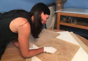
 Maps used by early Arizona Babbitts are now preserved and available in the Flagstaff City-Coconino County Public Library. Reference librarian and Babbitt relative Claudine Taillac says the weathered, frayed and stained documents likely were carried in pockets or saddlebags as ranchers rode horseback and moved cattle to pastures and water sources.
Taillac has been carefully preserving the documents this summer. Previously, they had been stored in the Babbitt Building and were donated to the library by Babbitt Ranches.
“They were working maps and were definitely used,” she said. “Some of them were rolled within one another. You could tell they were very dirty, lots of grime, some of the edges were threatening to fall off. It was pretty nerve-racking. They were so brittle.”
Taillac has a special connection to the old maps. Her grandmother, Emma Gene Babbitt Bader, was the granddaughter of David Babbitt, one of the original five brothers who came to Northern Arizona from Ohio to start the Babbitts’ cattle operation in 1886. Emma Gene was married in 1965 to Taillac’s grandfather, Lou Bader, who founded Baderville.
Taillac calls it an honor to be handling documents that would have been important to her grandmother. Bader died in January at age 97. “It’s really nice for me to be able to work with these maps that I’m sure her grandfather worked with.”
Taillac says Bader had a huge library. “She read all the time and would tell me stories about early Flagstaff like how she remembered gathering rocks to build the church downtown. I think she would be thrilled, as her grandfather would be I’m sure, that I was working at the library and having the chance to help preserve all these materials.”
Wearing white gloves, Taillac gently brushed Flagstaff’s early pioneering dirt from the century-old maps. The documents show no Forest Service Roads or even Lake Mary because it was not a natural lake and did not exist then. She says important landmarks in those days were individual ranches, springs and train tracks.
“Flagstaff was a very early town and it was very different from what it is now. A lot of families came here to homestead and the waterways were really important. Streets, of course, weren’t paved. I know even from my own personal family history my great grandfather would go from Fort Valley into town every day over A1 Mountain on his horse and back, and that was in 1919, just about 100 years ago.”
Some names have changed. Fort Maroni is now Fort Valley. And today’s Schultz Pass was originally Shulz Pass. Places like Hochderffer Ranch are identified, and also the Flagstaff Experimental Forest, which is now the Fort Valley Experimental Forest.
“This is the Atchison, Topeka railroad line here,” pointed out Taillac. “It shows that whole railroad system going through this one particular area, which I’m sure was extremely important for planning.”
To protect and preserve the maps, Taillac put them in a humidity chamber, a sealed bin that holds water. The water does not touch the documents, but it creates a moist atmosphere that relaxes the stiff paper within hours.
The freshly cleaned and refurbished maps are now protected in Mylar sheets and can be handled and studied. They are housed in the Arizona Collection alongside other rare documents at the library. Taillac says public programs will be created around them.
“Any time something like this pops up and we get a chance to reflect on how things were, it is just a wonderful opportunity. As information professionals, we’re always promoting growth, future knowledge and understanding so that we can all go into the future more informed,” she said. “Part of being literate and informed is having an understanding of the past.”
A video of the map preservation project is available on YouTube. FBN
By Bonnie Stevens, FBN
Photo caption:
Librarian Claudine Taillac points out landmarks identified on ranch maps used by her Babbitt relatives in the 1800s.


